No, this is not the most beautiful map in the world. But yesterday I bought it at the Little Flea Market on the corner of 19th and Q, near Dupont Circle. Why would I do such a thing?
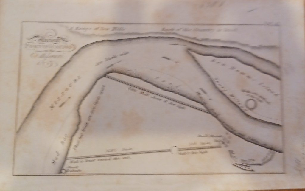
This map dates from 1814 or 1815, according to a pencilled reference. It shows a small portion of the Missouri River not far from St. Louis, near Bon Homme Island. It is from a book (as many old maps are).
You see Bon Homme Island in the upper right. Today, this fertile “island” is I believe no longer an island. The upper part of Bonhomme (now one word) Island is connected to mainland St. Charles County. I am not sure, but I think this land is now fertile farmland still prone to flooding. Someone can correct me. And, if you cross the river and head a tiny bit south, today you would find yourself in the heart of Chesterfield, in St. Louis County.
Back to the map. What else is interesting about it. For one thing, the date. Missouri became a state in 1820, five years after this map was published. For another, the only geographic name (other than the river itself) is French. Not surprising in that this land was part of the Louisiana Purchase, bought by the United States in 1803, twelve years before the map was published.
You may have figured it out. This is one of the maps made on the Lewis and Clark expedition of 1803. It was published in a book titled “Travels to the Source of the Missouri River”, published in 1814 and 1815 in London and the United States by Lewis, Clark and several others.
There are still copies of the publication available in the $15,000 range. I thought this map was worth the $10 that I spent.
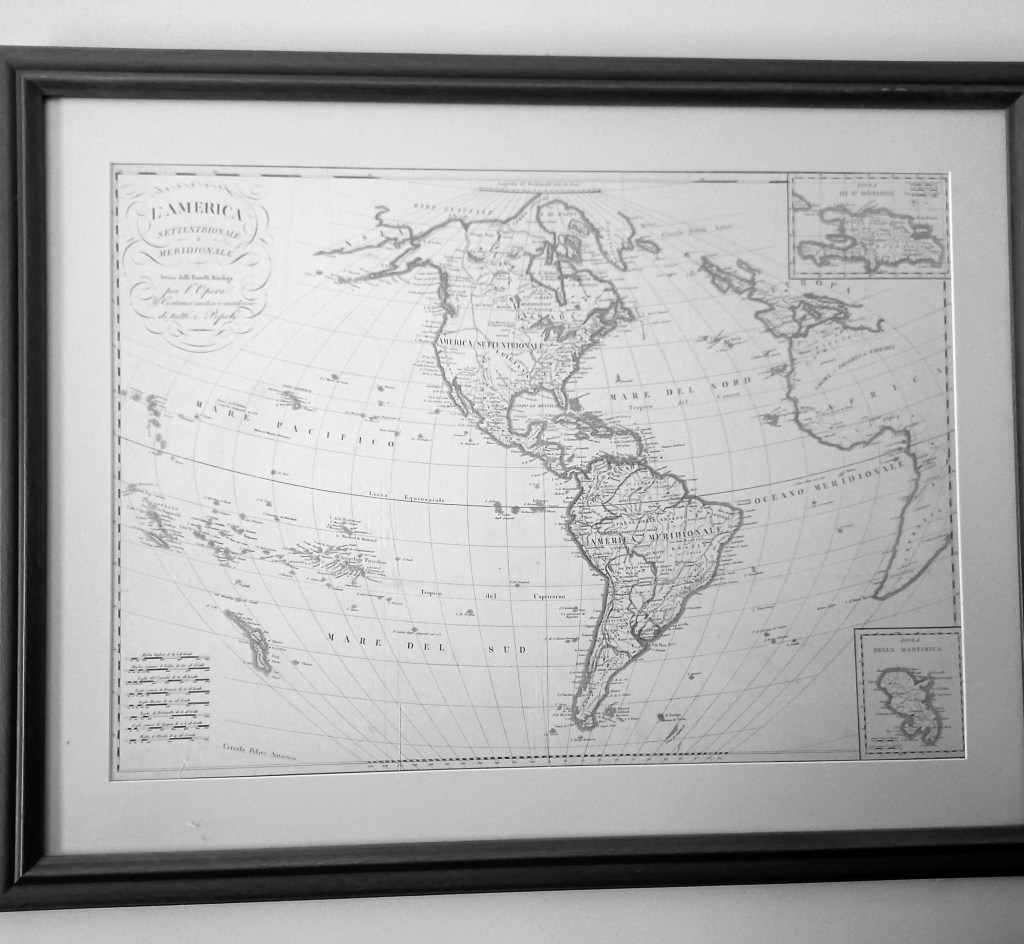
What called my attention to the vendor selling maps was this one. This map of the western hemisphere hangs in my home office now, but hung behind my desk in my various law offices for 40 years. I bought it in 1972 in Marbella, Spain.
It’s an Italian map, made by a cartographer named Bodiga and published in Milan in 1820. It does not yet show Missouri as a part of the United States, but rather as a part of a large territory called Luigiana. (By the way, this was the first time I connected Louis and Luigi.)
Yesterdsy, the vendor had a copy of this map posted on the wall of his cart. Not in perfect shape and not colored, but there it was. It obviously caught my attention.
That’s it for today. Tomorrow, maybe back to the 21st century.
